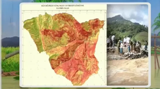
Landfall map for 15 Northern provinces

VTV.vn - For the first time, a landfall map for 15 northern mountainous provinces in Vietnam has been introduced.
The map provides detailed information on landfall risks and geographical conditions. Thanks to the map, landfall forecasting will become much easier and warnings can be issued earlier so that timely evacuations can be carried out to minimise losses.
Currently, the Ministry of Natural Resources and Environment is cooperating with the Central Steering Committee for Natural Disaster Prevention and Control to receive information from local authorities and continue to update the landfall map.
In addition, training courses are being carried out to instruct local officials on how to use the map effectively.


