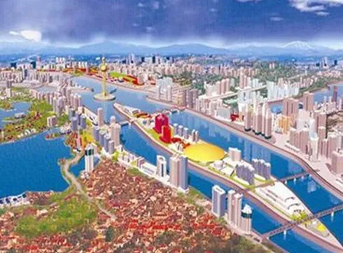
Hanoi seeks ideas to develop Red River banks

According to the decision of the municipal authority, three investors - Sun Group, Vingroup and Geleximco, will each devise plans and submit them to the municipal authority for selection. They can invite designing consultancy units to collaborate in the project. The final design ideas will be selected by March 30.
Chairman of the municipal People’s Committee Nguyen Duc Chung asked them to develop a scheme which ensures the city’s flood-resistant capability, effectively makes use of land funds and creates a modern urban area along the river, at a meeting with investors interested in the project.
Additionally, the scheme should give priority to on-site resettlement for local residents and develop waterway transportation and tourism.
The city has suggested two options for the scheme.
Option one is to build a new system comprising roads and dykes to replace the current dyke system. This will serve to protect the city from flood alarm level 3 , or emergency flood condition, which sees general and wide spread uncontrollable flooding and severe damage to infrastructure.
Option two is to build a new system of roads and dykes which can protect the city from flood alarm level 2, or dangerous flood condition, which means flood plane inundation expected, bridge foundations at risk but infrastructure generally safe. In addition, water reservoirs and canals will also be built to support the current dyke system, which is located further inland, to protect the city from flood alarm level 3 .
The planning scheme will be divided into two phases, with the first one covering the areas on the banks of the river from Thang Long Bridge to Thanh Tri Bridge and the second one covering the rest.
The Red River, originating in China, flows past Hanoi and several provinces in the north of Vietnam before emptying into the Gulf of Tonkin. Besides being one of the main river systems that plays a crucial role in irrigation and waterway traffic, the river is also seen as a symbol of the capital city.
Tags:


